Archive for December, 2009

One week ago I temporarily returned from riding and hiking in the tropics of Central America back to the normal everyday life at home (Florida). A great time to enjoy reconnecting with family, relaxing without day-long rides or hikes, replenishing energy and motivational reservoirs.
I also came back to the life of news, mainstream media and their end of decade reviews. I always liked the year-end reviews in the newspaper, as they are a bit more thoughtful and cover a greater time-span than the regular, short-term and superficial news-bites. And I particularly enjoyed this time around with the end-of-decade reviews.
The overall tone of this decade’s assessment is fairly negative; looking at the economy and financial world, Economics Nobel prize laureate and NYT Op-Ed Columnist Paul Krugman calls it the Decade of Zero, where we (Americans) have achieved nothing and – worse – learned nothing. Other writers call it the “Decade of Suck“. In the Palm Beach Post cover story “Ten Years that changed America” author Scott Eyman makes a few interesting observations:
“On the social and technological front, the increasing use of wireless networks intensified the clamorous yawp of the Internet. Audiences and media shattered into ever smaller shards. Movies played on iPhones, texts became tweets, people compulsively updated their banal daily activities on Facebook or the monkey chatter of Twitter. The obsessive nature of so much of the Internet culture, not to mention the accusatory shrillness bred by anonymity, led author Thomas Mallon to observe, “We’ve gone from how the unexamined life isn’t worth living to how the undocumented life isn’t worth living”.”
Some of his other comments also reflect what I feel has become a short-term, voyeuristic, living by proxy culture: “At the end of the decade, the culture was in an ever-increasing cycle of diversional sensation – David Carradine’s kinky death was replaced by Michael Jackson’s drug overdose, which was replaced by a succession of American dreamers of varying degrees of derangement in perpetual competition for their own reality show: Octomom, Jon & Kate, and Balloon Boy, who had their time in the sun waiting for Tiger Woods’ round robin of revolving mistresses to make people forget about David Letterman’s more limited indulgences.”
The interesting question here is: Why do we (on average) care so much? What is it that makes us consume so much trivial chatter? Is it the instant gratification of not needing to wait, act or think much for the short-term high of a news sensation? Of not having to get out there (how inconvenient) to get our own experiences?
I also read a few adventure review stories, including the review by Tarquin Cooper in the British Telegraph on A Decade of Adventure, the Top Ten adventure trends of the decade in AdventureTravel or the Top Ten Adventure Stories of the Decade in the Outside magazine. Plenty of big and familiar stories in there, including lots of cycling and hiking. Indeed, fellow adventurer Mark Beaumont, who had made the first list above, is doing a very similar project to mine called Cycling the Americas.
Some of this made me reflect on my own reporting about my project:
Is my unrecorded life worth living?
Who cares about my monkey chatter on Twitter?
Is my trip any different whether I have 50 followers or 50.000?
Do I have to be a first or break a record to count for anything?
I didn’t primarily set out to examine my life, although I don’t think I’m just recording it either. Looking at those images from traversed countries and climbed mountains brings back vivid memories, which will remain with me for the rest of my life and are somewhat accessible to all who care about them. There may be ever smaller shards of audiences, but to those few (and myself) the journey matters. In fact, inspiring people who I otherwise wouldn’t even have met was one of the most rewarding sensations I have had so far on this trip.
And I conclude that neither you or I have to be the first or fastest or fittest in order to have an extraordinary experience. People often ask me how I prepared or seem to imply that one needs to be superfit for such an adventure. You just need to be fit enough and – more importantly – committed enough to begin it. Most adventures fail not because people aren’t fit enough, but because they were never started in the first place. Something to ponder for all of us for the next decade!
December 31st, 2009


The last country on the first part of my journey is Panama. I crossed the border on December 18 and rode to the town of David. There I found a hotel near the bus terminal, arranged for my bike to be stored there for one night, changed into hiking cloths and hopped on a bus North to the little town of Boquete. This village in alpine setting around 1000m ASL is a nice contrast to the hot and humid climate near the Coast. Up here it reminds me of some of the mountain villages in Austria, with a river flowing through town and fresh cool air at night. I found a hostel next to the river with Internet, so I could update my SPOT page and check email. For the next morning I would get a cab and drive up to the National Park entrance.

Volcan Baru has an altitude of 3474m, which makes it the high point of Panama. From the NP entrance there is an elevation gain of about 1700m, plus a little bit of up-&-down along the way. In many descriptions it is recommended to hike up one day, camp near the top, get to the summit the next day at sunrise and then hike down. Alternatively, some guides offer to ascend at night to see the sunrise from the summit. The allure is to see both the Pacific and Atlantic at the same time when it’s clear in the morning. However, there was rain last night and it was generally cloudy, so I didn’t feel that sunrise would be visible or even without clouds. Secondly, I didn’t want to ascend the entire way in the dark. So I started the hike just around the first daylight.

The paths climbs mostly through cloud forest, with the occasional nice meadow. This is a 4-wheel drive track, pretty rough, but I did see both two ATVs and later two regular jeeps making their way up there. The reason for this road: There are about a dozen radio antennas near the top.
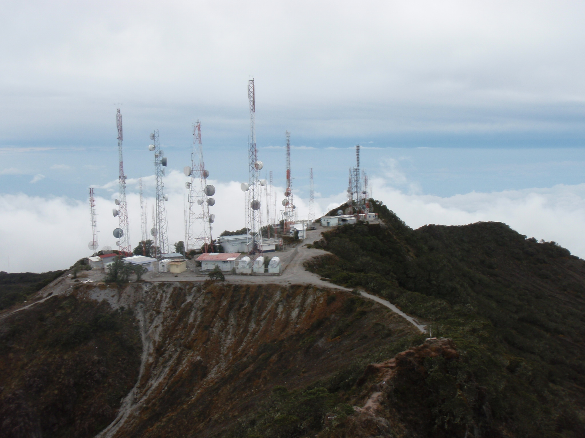
From those it is only another 10 minutes to the top of Baru. I could see the Pacific Ocean, but the Atlantic was completely covered in clouds.

Giong up took me 4.5 hrs, I stayed at the top for 0.5 hrs, and made a quick descent of 2.75 hrs. Round-trip time was 7 hr 45 min. It was a long hike (28 km round-trip, 1900m elevation gain), but I stayed dry all the way and was happy to have completed Panamerican Peak Number 10!

I went back by bus from Boquete to David and stayed there one night in the hotel. The next morning it was back to the hot and humid weather on the road. It was December 20th and I needed to be in Panama City (450 km) on the 23rd. No time for rest days, unfortunately. Instead I decided to go about 130 km each of the first three days.

Stefan Dudli (who owned my bike before and rode here on it 2 years ago) described this section on his website (www.panamerica.ch) as “HHH”: Hills, Heat, Hunger. My main problem now was the extreme heat. Often it got up to 37C (100F) and climbing the hills in stale, humid air was just extremely tiring. Throw in some Diesel exhaust of passing buses and then run short on daylight at the end of the day – this made this section very trying.

One day I ran out of daylight at a hilltop and looked for some place to stay. As there was no hotel I asked at the local police station and sure enough I could camp on their grounds.

Two days later I had a similar problem when the only hotel in town (Capira) had been closed and abandoned a few years ago. I asked the local firefighters and they let me camp on their grounds.

The last day had a much shorter ride, as I needed to get to near the airport with at least a half day to pack my bike. The 55 km from Capira to Panama City were relatively easy, but for the very poor quality road (50 year old cement road with lots of cracks and bad shoulder).

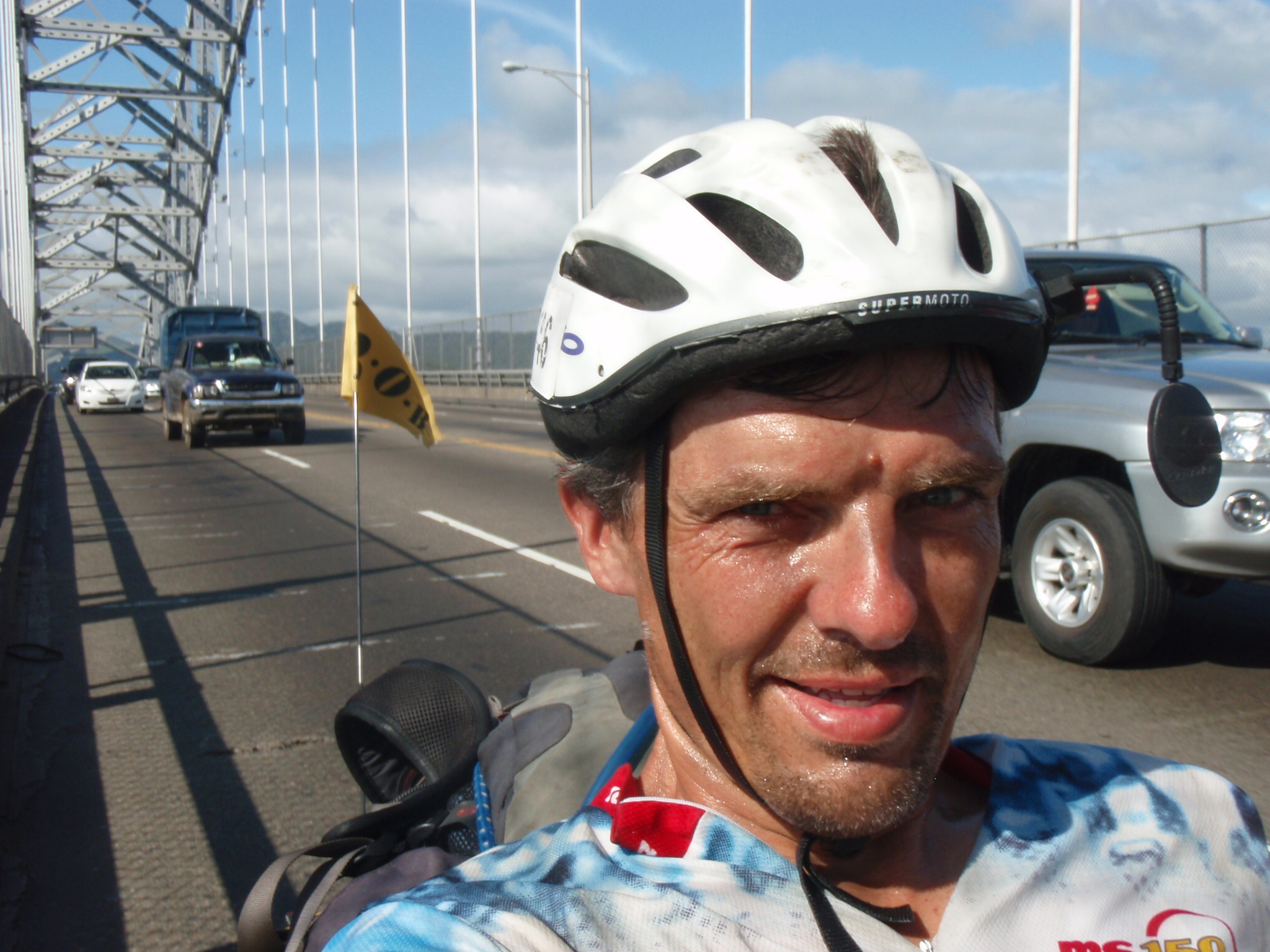
The last couple of km leading up to the bridge over the Panama Canal, the Puente de las Americas, were especially busy and narrow, some of the most dangerous riding on the entire trip. But the scenery over the bridge was a real highlight, and a geographic endpoint to this part of my journey. When I rolled down the other side of the bridge, emotions welled up and some tears of joy and relief rolled down my cheeks.
No time to slow down yet, though. I still needed to cross Panama City and get to the airport. They say Panama City is like Miami, except you hear more English spoken there 😉 It’s true, the skyline right along the water is very similar to Miami, and there is a lot of construction going on.

The rest of the day was pretty hectic: I looked for some breakfast with WiFi, but didn’t find WiFi despite checking in 5 places! So I continued to ride towards Tocumen about 20 km East of Panama City to get to the International Airport. There I checked into the main hotel, even though it’s prices are American. (I paid more for this last night than for all my stays in the last week or two.) But I needed a spacious room and I hadn’t had a shower in two days… Then I did my laundry and went to a nearby bike shop to get a box to pack my bike into. Cleaning and disassembling the bike took 3 hrs, almost as much time as the ride today. I also needed to pack my trailer and two panniers, plus dry out the tent and just generally sort my stuff. In between I had dinner and sent email as well as wrote this Blog post.
After nearly 6 months, 13.765km and 745 hrs of riding I had covered the entire distance from the Arctic Ocean to the Panama Canal. Except for the bus ride through Mexico City I rode my bike the entire way. And I hiked the 10 high-points of Alaska, Canada, U.S., Mexico, Guatemala, El Salvador, Honduras, Nicaragua, Costa Rica, and Panama. Except for not reaching the summit on Denali, the Panamerican Peaks adventure went very well according to plan so far. I am very pleased with Part 1. Now for a 2 week break at home for Christmas and New Year, then on to South America for Part 2.
December 23rd, 2009

After having spent a lovely vacation during Thanksgiving week in Costa Rica with my wife Jill I came back two weeks later by bicycle. Entering from the North from Nicaragua I rode to the town of Liberia for the first night and then stayed close to the Pacific Coast to avoid the high mountains in the center of the country. (The capital San Jose is already higher than 1000m ASL; the real killer, however, is the pass that follows, Cerro de la Muerte: It reaches an altitude of over 3400m ASL, making it the highest point of the Panamerican Highway. I couldn’t have done this in a reasonable amount of time with my heavy load…)
I stayed one night in El Roble (near Puntarenas); here I stopped in the evening at a pizzeria which had wireless Internet. The owner of the pizza place was so amazed about my bike and project that he called his buddy, who showed up with camera for a photo shoot. They planned to write a newspaper article about my story. The huge pizza was courtesy of the house; not only that, the brother of the family invited me to stay at his home for the night. So there I went meeting with the Baretto family, his wife and three boys.

In the morning I rode right along the Pacific, the first time actually since I arrived by ferry in Mazatlan, Mexico several thousand km earlier. Unlike in the previous days, it was already very hot at 7:30am in the morning; the proximity of the Ocean doesn’t allow for the air to cool off at night. My next destination was Quepos, where Jill and I had also made a rest stop on our drive back to the San Jose airport. It was fun to ride along the roads where we had already driven with the rental car just a few weeks ago.

In Quepos I checked into a small room and took a local bus to the tourist destination Manuel Antonio. Unfortunately it was already dark and it started raining heavily when I got there, so I didn’t see much of the beautiful beach there. Back in Quepos I woke up the next morning to thunderstorms and rain. It was my Birthday. So I decided to take it easy and have a breakfast buffet at the best local hotel, overlooking the Ocean from the 3rd floor restaurant. Eventually it stopped raining and cleared, so I continued by bike around 11am. The brandnew road goes straight through the palm plantations in this area. One can see the occasional truck load of palm nuts headed for the refinery.

My dad has a former school friend who moved to Costa Rica a few years ago and built a high-end resort. So I had this vague idea that I might stop by for a visit. As it happened, his place Cristal Ballena is located about 70 km from Quepos, an ideal distance for this half day. It was pure coincidence that it worked out to be my birthday, but it was a very fitting ambience for my special day. The resort is located on a 500 ft hill top between the Ocean and the rain-forest covered mountains in the back.

The hill made for a strenuous effort pushing up, but the views from up there are truly stunning. Check out their website to get a feel for this wonderful place, pool, restaurant and all. The Steiner family greeted me warmly and hosted me for the evening. We enjoyed a delicious dinner and some good conversation, including a philosophical parallel between the big projects of Panamerican Peaks and building a Costa Rica resort!

The Good-Bye on the next morning came all too soon – I would have liked to stay there for an extra rest day. But I needed to keep going to reach Panama City on time a week later. After spending another night in Neily I crossed the border to Panama on December 18. I felt at home in Costa Rica and will always remember the way how locals greet each other: Pura Vida!
December 22nd, 2009

Coming down the Panamerican Highway from the North I had seen borders with a significant poverty gap or income gradient. For example, the US – Mexico border in Tijuana, or the Mexico – Guatemala border near Tapachula. After reading a biker text book I expected a similar gradient when riding from Honduras into Nicaragua after Choluteca. Nicaragua is described as the 3rd poorest country (after Haiti and Bolivia) in all of the Americas, with poor roads and shanty towns / huts along the way.
However, after crossing the border I cycled along on a fairly new, perfectly engineered road with smooth pavement and wide shoulder. I hear the US had financed this road just about five years ago. (In fact, the highway in Costa Rica was both narrower and in parts of poorer quality.)

There were many new bridges built with various country flags indicating the donor nations (I remember Korea and Japan). There were no more or less simple huts than in El Salvador or Honduras. Quite the opposite, I noticed several new buildings with colorful paintings and lush gardens. There were no more or less cell phone towers and billboard signs, no more or less garbage along the road; I just couldn’t tell a difference.
Then I reached Leon with its colonial buildings and churches, a vibrant tourist town with lots of flair. Reminded me a bit of Morelia in Mexico, perhaps on a smaller scale and thus somewhat more peaceful. Nicas, as the people are called, seem friendly and industrious; I was still looking for the extreme poverty described as being palpable everywhere…

Unfortunately I had to cross Managua by bicycle, which was terrible. Traffic is very heavy and the roads are a nightmare (cobblestone, narrow roads with lots of potholes), it’s hot and stinky, walking around the hotel at night was not recommended – in short, a place to avoid if possible.
The mountains in the North with Pico Mogoton were similar to Honduras and El Salvador, with comparable road infrastructure and bus service. Lago de Managua and later Lago de Nicaragua provide a beautiful backdrop with volcanoes rising on islands in the middle. Nicaragua is rich in natural beauty and diversity.

The next gem was Granada, which sits on the shore of Lago de Nicaragua and has colonial architecture similar to Leon. Sitting at a restaurant at the central plaza I felt again like at the tocala of some nice little town in Mexico.

My last night I spent in Rivas near the Costa Rica border. Here the Nicas were again very friendly, from the restaurant owners who insisted on me bringing in my bike to the firemen who invited me to stay overnight to the retired Ivan (a Nica who had been businessman in the US) selling bread from the store in his house inviting me into his home for a chat over some coffee, reminiscing about old times.

A final sign of new development came on the last morning when riding South of Rivas along the lake shore. It was very windy, similar to Tehuantepec in Mexico; and just like there I came upon a wind farm with tall wind turbines. As I stopped for photos and just to take in the sight and sound of the giant, rotating rotor blades an armed guard approached from a nearby guard station. I suspected that he would send me away, but to the contrary he was happy to talk and inform me about this project built 2 years ago: 19 wind towers, producing 40 MW of power, with 11 more towers planned. The first such wind farm in Nicaragua, with several more in planning.

All the above (except Managua) left a positive impression on me. I think the chapters in the text book about Nicaragua will have to be rewritten somewhat, and hopefully with political stability and further investments the Nicas will soon get to enjoy more prosperity and climb up in the ranking and out of poverty.
December 17th, 2009

On the summit of Pico Mogoton, highest point of Nicaragua
Yesterday I reached the summit of Pico Mogoton, the highest point of Nicaragua. Interestingly, this was the 3rd peak where I stood with at least one foot in Honduras, as both El Salvador and Nicaragua high-points are on the Honduras border. That makes Honduras the only country with not just one Panamerican Peak, but actually three!

Roberto Castellanos leading the way up Mogoton
After doing some Internet research I found a good report done by Pavel Dorosevich, who climbed Mogoton in 2007, and another page summarizing the guide offers – thanks to Pavel for the writeup. Two days earlier I had sent an email to the contact address of one of the two local guides, Roberto Castellanos. Unfortunately he didn’t seem to check his email and so didn’t know about my plans. I went to his parents house – description from the website – and arrived there at 9:30pm after the 4 hr bus ride from Managua. They called Roberto and he showed up, drove me to a nearby hotel and picked me up the next morning at 5:00am. Think about that: He hadn’t been on the mountain since May, and then without notice at 10pm decides to do the tour the next morning 5am. (So much for me planning ahead! But anyway, I’m glad he was available.)

The 4-wheel drive road leading up to Finca Las Brisas where the Mogoton trail starts
Just the 4-wheel drive to the Finca where the trail starts is an adventure. Once we were on the trail, it quickly became apparent that this is no Gringo trail for the average tourist. It was scrambling up a river bed, around big boulders, through dense under brush, along slippery, rotten tree trunks and mud flats. At least the temperature was quite comfortable, as the trail began around 1300m and led straight up via pine forest into the cloud forest.

The first 200m we hiked up this river bed
Then at around 1500m the trail leaves the riverbed and leads very steeply up to a ridge. You have to use little tree trunks and branches to support yourself or pull yourself along as the trail was quite muddy and slippery and the terrain very steep. On the plus side, very little up & down (not like on Cerro Las Minas in Honduras) and gaining altitude quickly. There are several markers signaling the border between Nicaragua and Honduras. We were soon on the top after just 3 hr, unfortunately with no visibility.

On summit of Pico Mogoton with guide Roberto Castellanos
We took some pictures of the summit marker, but it was a bit ominous, dark, light rain, and breezy cold (only 15C). There were signs of (controlled) mine explosions near the summit, with little craters and blackened tree trunks with some roots ripped out of the ground. Also the yellow warning tape about landmines in many places. It’s hard to say how dangerous it was; probably no problem as long as you stayed on the trail, but definitely not a place to wander off the trail… Certainly not as lovely as it was on Tajumulco where I spend time laying barefoot in the grass…

Looking out through the cloud forest on the way down
Going down was relatively straightforward; one had to step carefully due to the steep and slippery terrain, often using trees to hold and support yourself. We saw exotic plants and mushrooms; we heard some birds but I didn’t see them. Also we didn’t see any monkeys, which are sometimes visible up here.

Unknown mushroom exhibited by my guide
Also the boulder hopping in the river bed requires really careful stepping so as to not slip and hurt yourself. After around 6 hrs we were back at the Finca with plenty of time to drive back out to Ocotal and for me to catch the last bus (3:30pm) back to Managua.
A big THANK YOU to Roberto, who served as a perfect mountain and nature guide, despite my extremely short notice. If you enlist his services (I paid $80) you won’t be disappointed.
The bus ride back to Managua was tolerable, with a pretty good bus again. Even though it said Express, it was an older model which went quite slow on some uphill stretches, and we ended up taking a full 4 hr again. I was drifting in and out due to the exercise, the heat in the bus and lack of sleep over the last few days. Getting back to the hotel near the bus terminal Mercado Mayoreo in the hot, dusty and loud city of Managua I thought back to the cool and tranquil environment up on Mogoton – what a difference to experience in a single day!
December 12th, 2009
Previous Posts