Salar de Uyuni
May 8th, 2010
One of the main reasons for me to ride through Bolivia on my Panamerican Peaks tour was to see the world’s largest salt flat, the Salar de Uyuni. From various cyclist reports I knew that riding on this sea of salt would be an extraordinary experience.
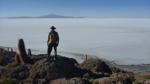
After arriving by train from Villazon to Uyuni I booked a one-day jeep tour out to the Salar. This gave me a rest day after the stressful 9hr night train ride and would also give me a feel for the size and condition of roads etc. During this jeep tour we crossed the Salar from the little village of Colchani (20km North of Uyuni) in the SE to the volcano Thunupa in the North. Two of the passengers had booked a two-day tour with a climb up towards the volcano, so we drove to the village on the base of the volcano to drop them off. Then on the way back we drove to the Isla Incahuasi in the middle of the Salar. There are some small and clean facilities as well as a nice walking path to the top of this island. The views from up there across the white sea of salt with the snow-capped peaks of the Cordillera rising on the horizon is exceptional.

Stunning views from the top of Isla Incahuasi across the Salar de Uyuni and the Cordillera peaks in the distance
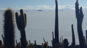
(Isla Incahuasi in the Salar reminded me of the Isla Taquile in Lake Titicaca.) Also spectacular cacti growing on this island, some more than a 1000 yrs old and up to 10m tall! All too soon we had to say Good-Bye to this place and head back some 50km across the Salar to Colchani, chasing our own shadow in a race against the clock and the setting sun.
Fresh rested and equipped with 10l of water and coke I headed out the next day to ride on the Salar. I left Uyuni behind knowing that there wouldn’t be much infrastructure for a long time and that I would probably not be able to get online for several days. After the first 20km I had lunch in Colchani, then took the ramp to get onto the salt flat, passing some of the structures built of salt like the Hotel de Sal as well as the commercial salt farms.
Now I was on the Salar – just endless white level salt stretching to the horizon in every direction. It was easier to ride following some tire tracks, almost like ski tracks in backcountry snow.
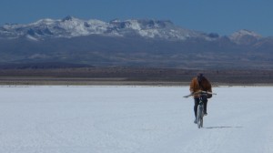
I changed my helmet against the brimmed sunhat and applied sunscreen and lip balm every hour or so to protect my skin from the intense radiation. Hours passed heading towards the North with volvano Thunupa as beacon in the distance. After about 2 hrs or so I met a local cyclist who was riding out to a little hut cutting salt for a living. I can hardly imagine an encounter of two more different cyclists in a more surreal setting than this!
Hours went by without much change in the scenery; this was similar to the 30km straight roads along the pampa in Argentina, but here it was all endless in 2 dimensions. I stopped every hour or so for a drink and more sunscreen. There were no cars or human beings anywhere since several hours. Out here I was on my own. Due to the somewhat bumpy ride and a slight headwind my speed was only around 12-15 km/h. I soon realized that I wouldn’t be able to cross the Salar today. But I had wanted to spend a night out here anyway and I came prepared.
The shadows got longer and the colors more vivid. 1/2 hr before sunset I stopped, moved aside from the tire tracks (to be safe in the unlikely event that a car would follow those overnight) and set up my tent.
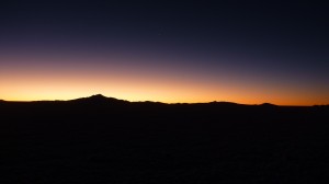
Some photos just before sunset, which you can literally feel on your skin, as the temperature immediately starts dropping once the sun disappears. I spent the next 20min or so eating in my tent while it got dark and the stars emerged. The night sky out here is brilliant, with the Milky Way as clear as ever. One can even see the Magellan Cloud, our nearest galaxy. There is no artificial light or any sign of human activity out here. No dogs barking in the distance, no trucks, no TV or radio, no animals, nothing. The silence, darkness and solitude out here is so profound, it’s very serene. One of the most unique and awesome experiences of my entire trip!
The thermometer dipped down to -3C and my water bottle on the bike had some ice in it. But there was very little wind and with my good equipment I didn’t have a problem with the cold. Next day the sun rose at 7am and quickly warmed the air again. I packed away my tent and continued heading North. Eventually I found tire tracks leading to an exit to the NE and so left the Salar again. The following 2 days of riding were very hard, through very remote areas and tiny villages, with local farmers working the seasonal Quinoa harvest and an even colder night (-8C) in the tent. The roads are particularly challenging, with gravel, sand, at times large rocks, rivers without bridges, mudflats, and some washboard. Bike and rider take a beating on those stretches, but that seems to be the price of admission to crossing the Salar… Once back to the good roads and even pavement near Huari the poor quality of the roads will soon be forgotten, but the impressions of the Salar likely will remain burned into memory forever!
SPOT track of last week’s ride from Uyuni to Patacamaya (near La Paz):
Bolivia Ride and Salar de Uyuni
Share your Adventures with SpotAdventures
Entry Filed under: Uncategorized


2 Comments Add your own
1. Travel Nerd | August 20th, 2012 at 2:15 pm
I would love to return to the Salar to cycle from La Paz down to San Pedro de Atacama.
I read so many different posts that I am not sure anymore if End of November is a good time to go. Regarding to the weather charts and other sources it is the beginning of the rainy season (November).
On the other hand I read posts were people cycled through it when the Salar was completely covered by water.
Don’t get me wrong…. I don’t mind a shower or putting up my tent in pouring rain but I am not so sure regarding the tracks. Pushing your bike through pure mud for days is rather a challenge than pure joy 🙂
Of course I could go around it but then I would miss too much nice scenery.
Would be nice to get a feedback from someone who did it. At what time of the year did you do it (hard to tell by just looking at the date of the blog entry).
In short: Would you recommend to cycle that stretch in November?
2. Administrator | August 21st, 2012 at 2:10 pm
Travel Nerd,
unfortunately I don’t know whether November is a good time of the year for the Salar de Uyuni. When I crossed it in May the weather was dry, cold (below freezing) at night and hot during the day with little wind. I can tell you that cycling would be very difficult on the Salar after heavy rains due to the salty mud it creates. In fact, to get off the Salar in the NE corner I needed to find and then follow a path the beginning of which (out on the salt lake) was marked by a large truck tire. Without that track one would have had to cross muddy areas almost impassable with a heavy touring bike. It felt like slushy snow, and riding in it was impossible. Hauling and pushing your bike across any distance in such conditions would have been very slow and tedious. Furthermore, during rainy and cloudy weather navigation might be a challenge, as you wouldn’t see anything in a whiteout and be lost without GPS or at a minimum a compass.
Check the weather forecast for November and experiences of other travelers, then make a decision. Whatever you do, be prepared and tell others when and where you’re planning to go. If you get hit by bad weather, you may have to stay put for a few days, so be prepared for that.
Cheers and Safe Travels,
Thomas.
Leave a Comment
Some HTML allowed:
<a href="" title=""> <abbr title=""> <acronym title=""> <b> <blockquote cite=""> <cite> <code> <del datetime=""> <em> <i> <q cite=""> <s> <strike> <strong>
Subscribe to the comments via RSS Feed